
New York State
Legend
New York State
Legend
| West Point, and scenes in Vicinity | 1886, Pic. America | 9-1/2" x 6" | WE-VF | $45 |
| Rev. map, NY Is. and part of Long Is. | 1872, Virtue | 8-3/4" x 5-1/2" | SE-G | $65 |
| Rev. Map, Ft. Washington and NY Is. | 1839, Boynton | 7-1/2" x 4-1/2" | CP-VG | $45 |
| Rev. Map, Plan North River | 1806, Marshall | 9" x 6-1/2" | CP, OC-VG | $110 |
| Rev. Map, Lake George | 1852 | 5" x 7-3/4" | Lith.-F | $30 |
| Mohawk River, German Flats | 1850, Valentine | Lith.-F | $40 | |
| Whilestown in 1802 | 1851, Valentine | Lith.-VG | $20 | |
| 3 Maps of NYC | 1864 | Lith.-VG | $40 | |
| Little Falls in 1802, Utica in 1802 | 1851, Valentine | Lith.-VG | 2-$30 | |
| Lake Ontario Fortification | 1851, Valentine | Lith.-VG | $30 | |
| Randall's Is. 1835 | 1855, Valentine | Lith.-VG | $35 | |
| Lac Ontario, Plan of Ft. Niagara | 1851 | Lith.-VG | $10 | |
| Map of the Genesee Country, Legend on the back | 1849, Valentine | Lith.-F | $30 | |
| Ft. in New York w/ Legend | 1853, Valentine | Lith.-VG | $5 | |
| Owasco Lake, New York | 1912, Bull | Chromolith.-F | $35 | |
| Frontispiece, American Scenery, Bartlett | 1838, Virtue | SE-G | $50 | |
| Macomb's, Purchase, New York, Lake Ontario | 1850, Govt. | Lith.-VG | $30 | |
| Map of Dunkirk Harbor, New York | 1855 | Lith.-F | $35 | |
| Colombia County, Livingston | c.1850, Valentine | Lith.-VG | $25 | |
| Harbor of Oswego | 1855, Valentine | Lith.-F | $25 | |
| Adirondacks, Circle Map | c.1888, Stoddard | OC, Lith.-Fair (-) | $30 | |
| Piers on the East River | 1848, Valentine | Lith.-G | $35 | |
| Sodus Bay, Lake Ontario, Kayuga County | 1853, Valentine | Lith.-VG | $35 | |
| Elmira, Ft. Hill | 1853, Eastman | Lith.-F | $35 | |
| Greater NYC | 1881 | Lith.-F | $35 | |
| Village of Buffalo | c.1860, Govt. | Lith.-Fair | $30 | |
| Manor Renselaerwick 1767 | c.1850, Valentine | Lith.-F | SOLD | |
| First Settlements in NY State | Chromolith.-F | $35 | ||
| Westfield, NY, Soil | 1901, Govt. | Chromolith.-F | $25 | |
| Johnson Grant to Indian Heirs | 1850, Valentine | Lith.-F | $30 | |
| Genesee Lands, Ontario County | 1850, Valentine | Lith.-F | $45 | |
| Towns of Livingston (1798) | 1850, Valentine | Lith.-F | $125 | |
| NY Harbor, Buttermilk Channel, East River | 1872, Govt. | Lith.-F | $35 | |
| NY and Brooklyn | 1847, Williams | Lith.-VG | $55 | |
| Plan of NYC in (1869) | 1869, Valentine | Lith.-VG | SOLD | |
| Long Is. | 1853, Govt. | Lith.-F | $65 | |
| New York Agri. Map | 1901, Govt. | Chromolith.-F | $25 | |
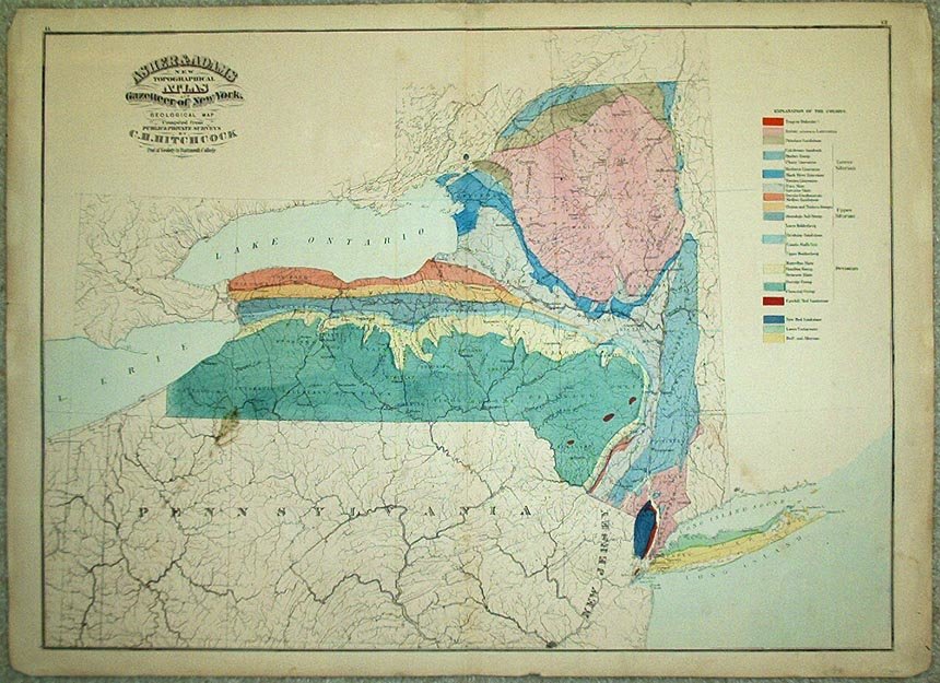
| Topographical Atlas & Gazetteer of New York, Geological Maps | c1890, Asher & Adams | 16½" x 22" | CL - VG | $125 |
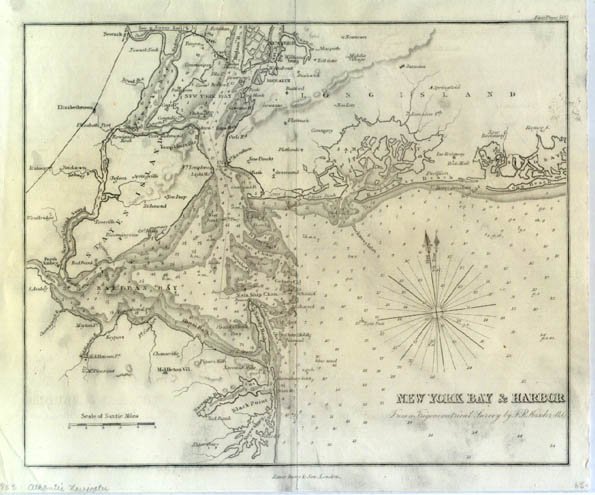
| New York Bay and Harbor | 1855, Imray & Son | 7-1/4" x 8" | CP-VG | $65 |
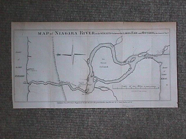
| Map of Niagara River | 1851, Elliott | 8" x 17" | Lith.-VG | $95 |
| Macomb's Purchase | 1851, Valentine | 13-1/2"x14-3/4" | Lith-F | $75 |
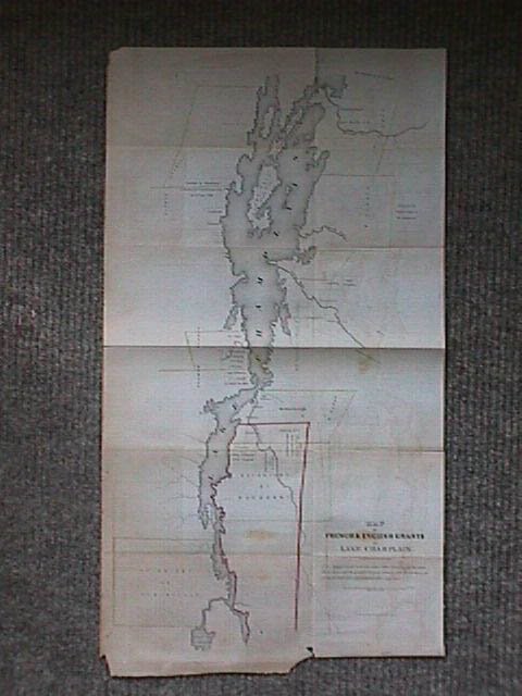
| French and English grants on Lake Champlain | 1849, Valentine | 23" x 12" | OOC, Lith.-VG | SOLD |
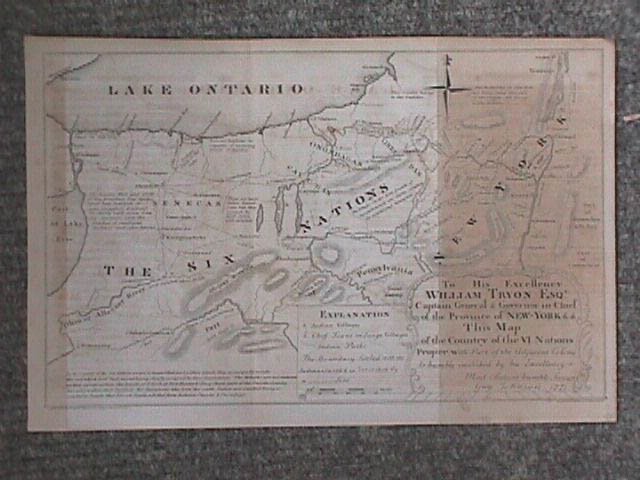
| William Tryon, Esq., Country of VI nations, 1771 | 1851, Valentine | 7-3/4" x 12" | Lith.-F | $95 |
| Sir W. Johnson's grant to his natural Indian children, 1791 | 1849, Valentine | 8-1/2" x 11-1/2" | Lith.-F | $50 |
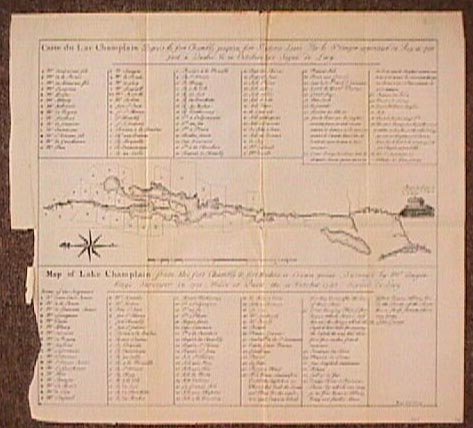
| Lake Champlain, Fort Chambly to Crown Point, 1748 | 1849, Valentine | 12-1/4" x 13" | Lith.-VG | $95 |
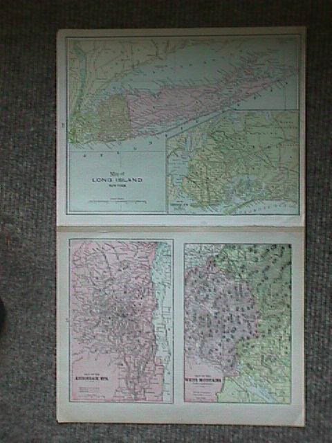
| 3 / 1, Map of Long Island, Adirondack & White Mts. NY State, verso | c1890, Anon. | 8-1/2" x 13-1/4" | F | $65 |
| Plan of Oswego, 1727 | 1849, Valentine | 10" x 14-1/2" | Lith.-VG | $45 |
| New York County Map: Delaware, Greene, Columbia, Sullivan, Ulster, Dutchess, Orange, Putnam | 1880, Asher & Adams | 16" x 23" | Chromolith.-F | SOLD |
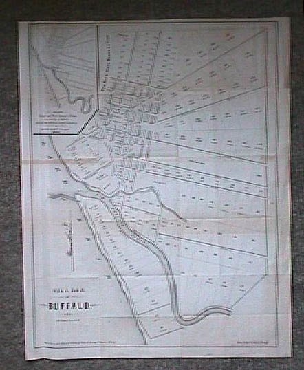
| Village of Buffalo w/ inset of Village of New Amsterdam, 1804 | 1851, Valentine | 20" x 16" | Lith.-VG | $125 |
| Topo Map of the country between the Mohawk River and the Wood Creek, 1758 | 1851, Valentine | 17" x 20" | Lith.-F | $75 |
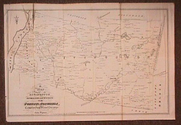
| A map of the towns of Livingston, Germantown, and Clermont in the county of Columbia, 1798 | 1850, Valentine | 15-1/2"x22-1/2" | Lith.-VG | $75 |
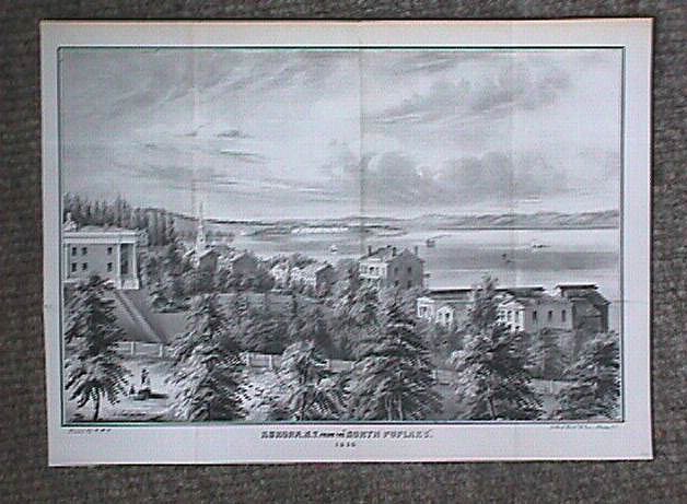
| Aurora, NY, from the "North Poplars", 1848 | 1848, Valentine | 9" x 13-1/2" | Lith.-VF | $95 |
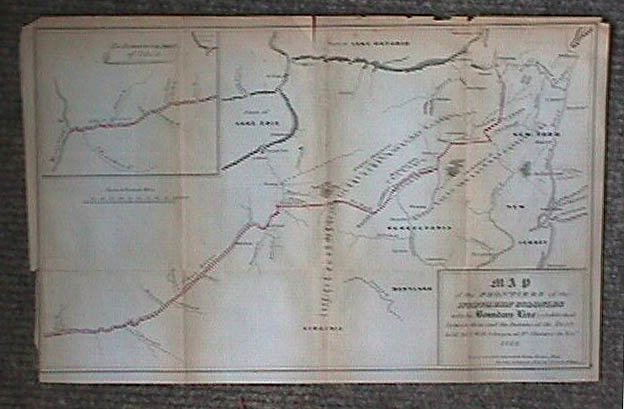
| Map of the frontiers of the Northern Colonies with the boundary line, 1768 | 1849, Valentine | 11-1/2" x 17" | OOC, Lith.-VG | $125 |
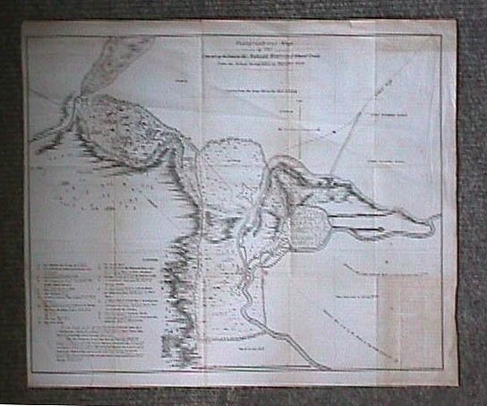
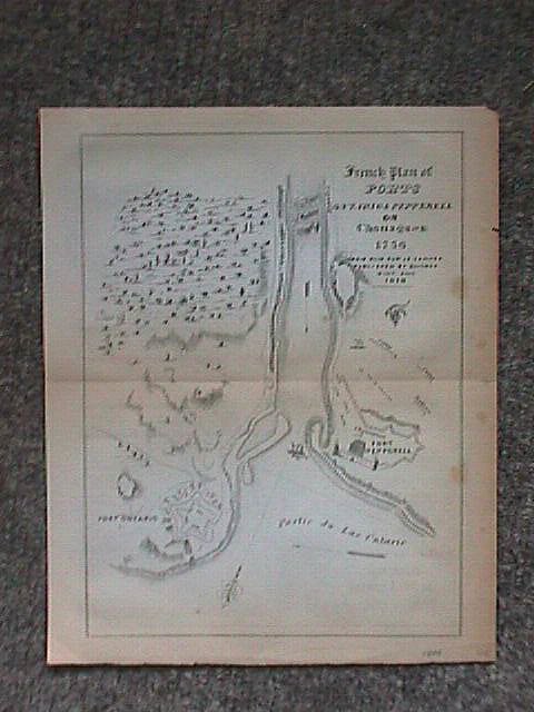
| French Plan of Forts Ontario and Pepperell or Chouaguen, 1756 | 1849, Valentine | 8-3/4" x 7" | Lith.-F | $45 |
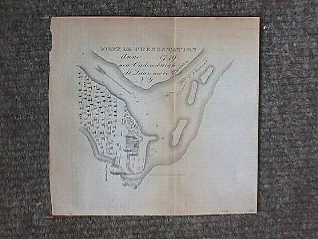
| Fort la Presentation, 1749 | 1849, Valentine | 6" x 6" | Lith.-F | $35 |
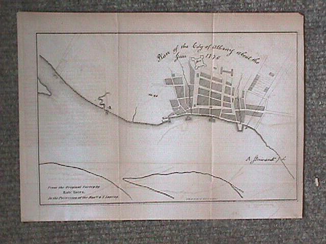
| Plan of the City of Albany about the year 1770 | 1851, Valentine | 8" x 12" | Lith.-F | $95 |
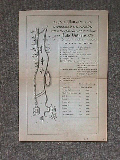
| Plan of the Forts Ontario & Oswego | 1849, Valentine | 8-3/4" x 5-1/2" | Lith.-F | $85 |
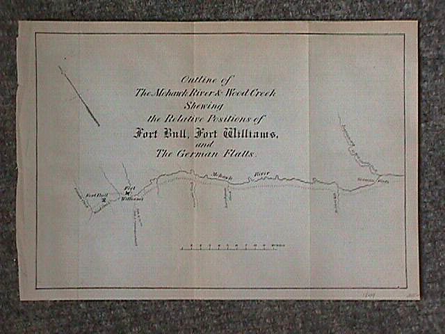
| Outline of the Mohawk River and Wood Creek, shewing the relative positions of Fort Bull, Fort Williams and the German Flats | 1849, Valentine | 7" x 8-3/4" | Lith.-F | SOLD |
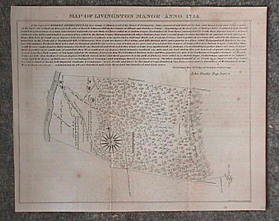
| Map of Livingston Manor, 1714 | 1851, Valentine | 8-1/4" x10-1/4" | Lith.-F | $100 |
| Western New York in 1809 | 1851, Valentine | 8" x 9-1/2" | Lith.-F | $95 |
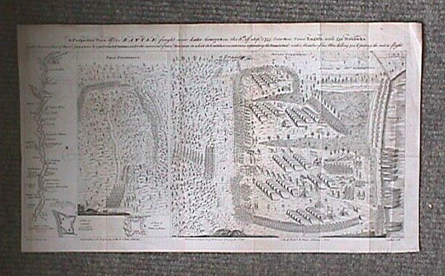
| A perspective view of the battle fought near Lake George, on the 8th of Sep. 1755, between 2000 English, with 250 Mohawks, under the command of Gen. Johnson | 1852, Valentine | 11-1/4" x 20" | Lith.-F | SOLD |
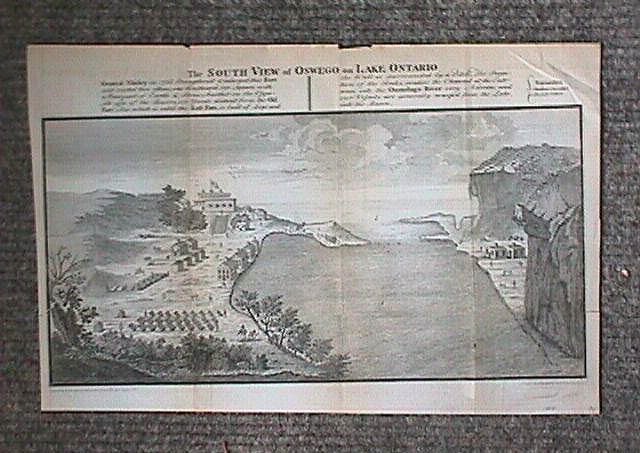
| South View of Oswego on Lake Ontario | 1849, Valentine | 9" x 14" | Lith.-F | $95 |
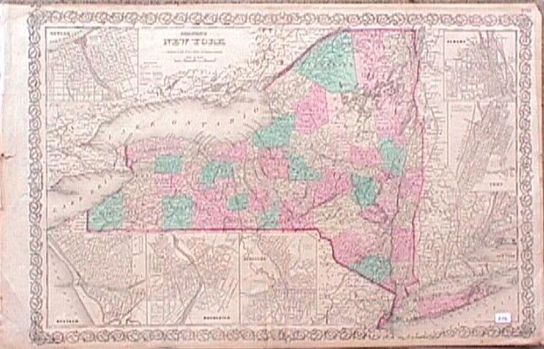
| New York w/ inset of Oswego, Buffalo, Rochester, Syracuse, Albany, Troy, New York City | 1858, Colton | 17" x 25" | OC, Lith. - VG | $125 |
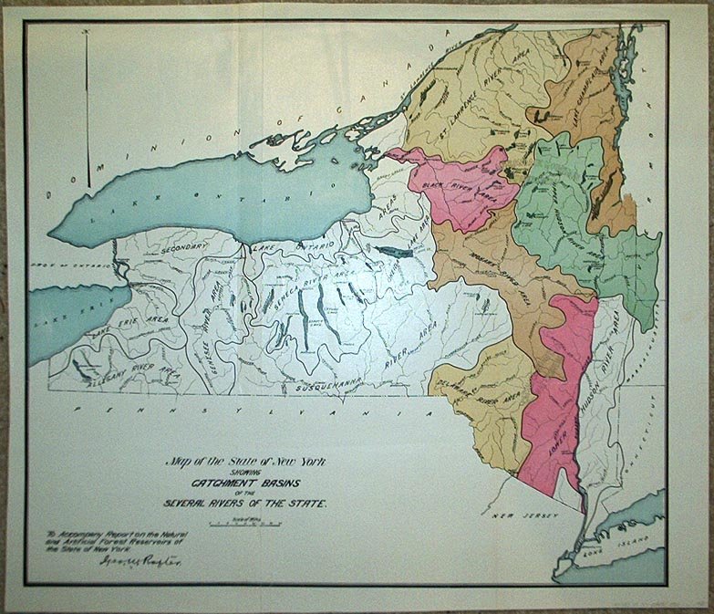
| New York State (River Basins) | 1900, Rafter | 15" x 17¼" | OC, Lith. - F | $40 |
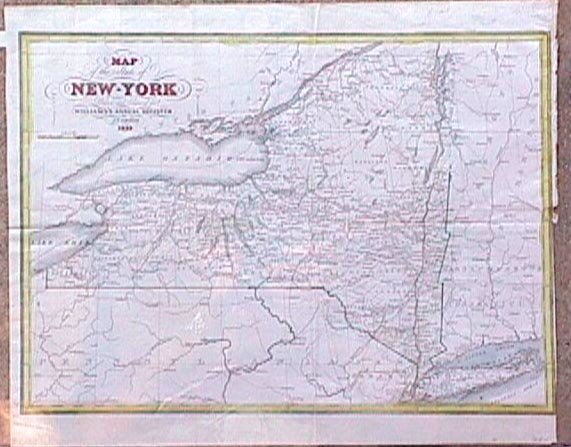
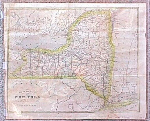
| New York State | 1835, Hammond | 12" x 15½" | C, CP - VG | $65 |
| New York State (x2) | 1841, Howe | 11½" x 14" | OOC, CP - F | $65 |
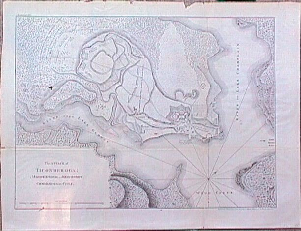
| Attack on Ticonderoga | c.1870, Gavit | 14¼" x 18½" | B/W, Lith. - G | $50 |
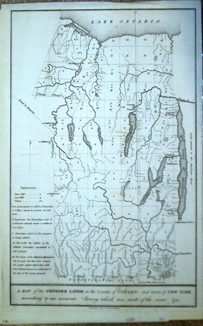
| Genesee Lands, Ontario County | 1849, Pease | 13" x 8" | B/W, Lith. - F | $40 |
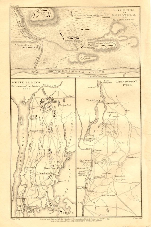
| Battle Fields of Saratoga, White Plains, and Upper Hudson | 1849, London | 9" x 5½" | Lith. - F | SOLD |
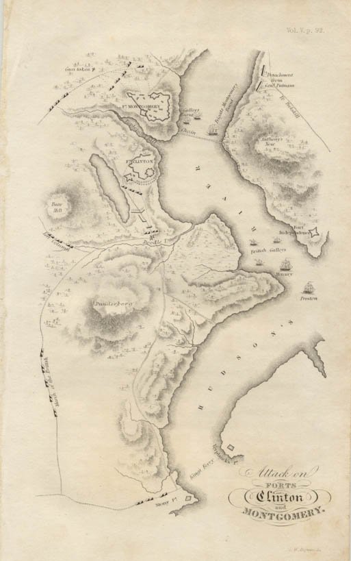
| Attack on Forts Clinton and Montgomery | 1834, J. Sparks | 7" x 4½" | CP - F | $35 |
| The Country Between the Mowhawk River and Wood Creek | 1851, Pease | 17" x 20¼" | Lith. - G | $45 |